Ontario is home to some incredible hiking trails, from peaceful forest walks to challenging climbs with spectacular views. Whether you’re looking for a short family adventure or a full-day hike through rugged wilderness, Ontario Provincial Parks offer plenty of opportunities to get outside and explore.
Some trails lead to waterfalls, while others take you along the shores of the Great Lakes or up rocky ridges overlooking forests and lakes. You don’t have to be an experienced hiker to enjoy these places, either. Many parks have shorter, easier routes that are perfect for beginners and families.
We’ve selected nine Ontario Provincial Parks with some of the best hiking trails in the province. Each offers something different, including scenic lookouts, unusual geological features, beautiful forests, and waterfront scenery.
We’ll explore the standout trails in each park, their distances and difficulty levels, and what you should know before visiting.
Ontario Provincial Parks With Great Hiking Trails: A Quick Comparison
Not sure where to start? This table compares some of the featured trails to help you find a hike that matches your interests and experience.
| Provincial Park | Featured Trail | Distance | Difficulty |
|---|---|---|---|
| Algonquin | Hardwood Lookout | 1 km | Moderate |
| Killarney | The Crack | 6 km | Difficult |
| Sleeping Giant | Top of the Giant | 21.8 km round trip from parking | Difficult |
| Lake Superior | Orphan Lake | 8 km | Moderate |
| Bon Echo | Cliff Top | 1.5 km, plus water access | Moderate to difficult |
| Pinery | Riverside | 1 km | Wheelchair accessible |
| Arrowhead | Stubb’s Falls | 2.6 km | Easy |
| Awenda | Bluff | 13 km | Moderate |
| Restoule | Fire Tower | 4.1 km | Rugged sections |
Trail distances and difficulty descriptions are based on Ontario Parks information. Hiking times and conditions vary. Some routes require additional travel from the parking area or special access arrangements.
Remember, a trail’s distance doesn’t always tell you how difficult it will be. A relatively short hike involving steep climbs and loose rocks can be more challenging than a much longer walk on level ground.
Algonquin Provincial Park: Classic Ontario Wilderness Hiking
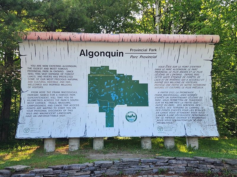
Algonquin Provincial Park is one of Ontario’s most recognizable outdoor destinations, and its hiking opportunities are a big reason why.
Located between Georgian Bay and the Ottawa River, the park features beautiful lakes, hardwood forests, wetlands, and rocky lookouts. The Highway 60 corridor provides access to numerous interpretive hiking trails, making Algonquin an excellent destination for both casual walkers and experienced hikers.
Hardwood Lookout Trail
- Distance: 1 km loop
- Difficulty: Moderate
- Estimated time: 45 minutes
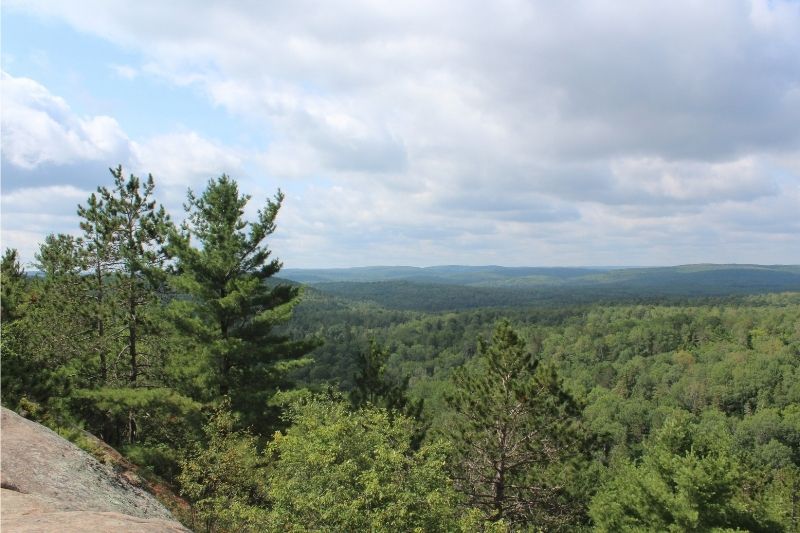
Hardwood Lookout is a relatively short trail that introduces visitors to Algonquin’s hardwood forests. The route finishes at a lookout with views of Smoke Lake and the surrounding hills.
Although the distance is short, the trail is rated moderate rather than easy. Expect uneven terrain and some climbing along the way.
It’s a good option for hikers who want a scenic viewpoint without committing several hours to a longer trail.
Track and Tower Trail
- Distance: 7.5 km loop
- Difficulty: Moderate
- Estimated time: 4 hours
Track and Tower is one of Algonquin’s best-known hiking trails. It combines forest scenery, historical interpretation, and a spectacular lookout overlooking Cache Lake.
The trail follows varied terrain, including hills and rocky sections. Interpretive information explains aspects of the area’s railway history and natural environment.
This is a great choice for hikers who want something more substantial than a short nature walk.
Centennial Ridges Trail
- Distance: 10 km loop
- Difficulty: Strenuous
- Estimated time: 3–4 hours
Centennial Ridges is designed for hikers who are comfortable with a more demanding outing.
The route travels across two elevated ridges, providing impressive views of Algonquin’s forests and lakes. Its climbs and rugged terrain make proper footwear and a reasonable level of fitness important.
In autumn, the elevated viewpoints are particularly appealing when the surrounding hardwood forests change colour.
Planning your visit: Algonquin’s Highway 60 trails have designated access points. Check the park map and trailhead location before setting out, and obtain the appropriate day-use permit.
If Track and Tower interests you, read our article, Why the Track and Tower Trail Is One of Ontario’s Best Hikes, for a closer look at this popular route.
Killarney Provincial Park: Spectacular Views of the La Cloche Mountains
Killarney Provincial Park is famous for its white quartzite ridges, clear lakes, and rugged Canadian Shield landscapes.
Located near Georgian Bay, southwest of Sudbury, the park offers some of Ontario’s most impressive hiking scenery. Many trails travel over uneven rock, so even shorter hikes can require careful footing.
The Crack Trail
- Distance: 6 km
- Difficulty: Difficult
- Estimated time: 4 hours
The Crack is one of Ontario’s most celebrated day hikes.
The trail climbs through forested terrain before reaching a steep section filled with enormous boulders. Hikers must work their way through the rocky opening that gives the trail its name.
At the top, panoramic views reveal the white La Cloche Mountains, surrounding forests, and lakes.
The climb is physically demanding, especially over the large boulders near the summit. Ontario Parks recommends attempting this trail only if you’re in good physical condition and can get an early start.
Sturdy hiking boots, sufficient drinking water, and a trail map are important.
Chikanishing Trail
- Distance: 3 km
- Difficulty: Moderate
- Estimated time: 1.5 hours
Chikanishing offers a very different hiking experience from The Crack.
Instead of climbing high into the mountains, this trail crosses a series of smaller rocky ridges before reaching the wave-washed shoreline of Georgian Bay.
Along the way, hikers can enjoy views of the water and the La Cloche Mountains to the north.
Although the trail is shorter, exposed rocks can become slippery when wet. It is not simply a flat walk along the waterfront.
Is Killarney Good for Beginners?
Beginners with reasonable fitness may enjoy Chikanishing, but should be prepared for rocky footing.
The Crack is better suited to experienced hikers or physically fit beginners who understand the demands of the climb. Families with younger children should be particularly cautious when selecting a route.
Important: The Crack and Chikanishing have specific day-use permit requirements. Even registered campers must obtain the appropriate trail permit. Check current arrangements before arriving.
Sleeping Giant Provincial Park: Incredible Lake Superior Lookouts
Sleeping Giant Provincial Park, near Thunder Bay, is one of Ontario’s most dramatic hiking destinations.
The park occupies part of the Sibley Peninsula, extending into Lake Superior. Its landscape includes towering cliffs, rocky shorelines, dense forests, and more than 100 kilometres of hiking trails.
Some routes are short nature walks, while others involve long climbs through remote wilderness.
Top of the Giant Trail
- Total distance: 21.8 km round trip from the South Kabeyun parking lot
- Difficulty: Difficult
- Estimated time: 6–10 hours
Top of the Giant is an unforgettable hiking objective for experienced outdoor enthusiasts.
The route follows an approach trail before climbing toward the top of the Sleeping Giant. The summit area provides remarkable views of Lake Superior and the Sibley Peninsula.
Reaching the viewpoints requires considerable physical effort. The complete outing includes a long approach, sustained climbing, and a return journey that can take most of the day.
One detail worth understanding is the distance. The Top of the Giant Trail itself is shorter, but the full hike from the main parking area is approximately 21.8 kilometres.
This is not a hike to begin late in the afternoon.
Plan for changing weather, limited cellular service, and the possibility of spending substantially more time on the trail than expected.
Sea Lion Trail
- Total distance: 2.4 km round trip from parking
- Difficulty: Moderate
- Estimated time: Approximately 1 hour
For visitors who want a shorter hike, Sea Lion Trail offers a fascinating geological attraction.
The route branches from the Kabeyun Trail and passes a pebble beach before reaching a natural rock arch beside Lake Superior.
The arch, known as the Sea Lion, is composed of dark volcanic rock called diabase.
Although considerably shorter than Top of the Giant, the approach includes uneven rocky terrain.
Easier Trails at Sleeping Giant
Not every visit requires an exhausting climb.
Plantain Lane Nature Trail is a 0.6 km round-trip walk near the Marie Louise Lake Campground. It crosses Sibley Creek and is listed by Ontario Parks as wheelchair accessible.
It’s a useful alternative for visitors seeking a short, gentle outing.
Planning your visit: Lake Superior’s weather can change quickly, and exposed viewpoints require caution. Stay back from cliff edges and allow extra time for difficult terrain.
For additional trip-planning information, see our guide, Visiting Sleeping Giant Provincial Park: What You Need to Know.
Lake Superior Provincial Park: Waterfalls, Rugged Shores, and Forest Trails
Lake Superior Provincial Park stretches along a scenic section of Highway 17 north of Sault Ste. Marie.
The park combines boreal forests, rugged hills, waterfalls, and dramatic Lake Superior shorelines. Its hiking trails range from relatively easy riverside walks to challenging wilderness routes.
Several trails are accessible directly from Highway 17 or designated park access areas.
Orphan Lake Trail
- Distance: 8 km loop
- Difficulty: Moderate
- Estimated time: 2–4 hours
Orphan Lake is one of the park’s most varied day hikes.
The route travels through hardwood and evergreen forests, including an area affected by a 1998 forest fire. A side trail provides views overlooking Lake Superior.
Farther along, hikers reach a pebble beach on the lake before following the Baldhead River upstream past several waterfalls.
The trail then climbs toward Orphan Lake and returns through forested terrain.
It’s an appealing option for hikers who enjoy changing scenery rather than a route focused on a single lookout.
Nokomis Trail
- Distance: 5 km loop
- Difficulty: Moderate
- Estimated time: 1.5–3 hours
Nokomis Trail begins at the Old Woman Bay day-use area.
The route climbs through boreal forest to elevated viewpoints overlooking Lake Superior. From certain locations, hikers can see the dramatic cliff formation associated with Old Woman Bay.
The final descent is steep, so hiking boots with good traction are recommended.
Pinguisibi Trail
- Distance: 6 km return
- Difficulty: Easy
- Estimated time: 1.5–3 hours
Pinguisibi, also known as the Sand River Trail, follows a historic travel route used by the Ojibwe.
The trail passes several waterfalls, rapids, and quieter stretches of river. The first waterfall is only a short walk upstream, allowing visitors to enjoy some scenery without completing the entire route.
It’s an excellent alternative for families or hikers who prefer riverside scenery over steep climbs.
What About the Coastal Trail?
Lake Superior Provincial Park also offers a demanding Coastal Trail for experienced wilderness hikers.
This route involves difficult footing, rocky shoreline sections, and remote conditions. Weather can change rapidly along Lake Superior, making proper planning essential.
If you’re new to hiking, begin with one of the park’s established day trails before considering a backcountry adventure.
Bon Echo Provincial Park: Hiking Above Mazinaw Lake
Bon Echo Provincial Park is best known for Mazinaw Rock, an enormous cliff rising above Mazinaw Lake.
Located north of Cloyne in eastern Ontario, the park combines impressive geological scenery with forests, wetlands, and lakes.
One of its most interesting hiking experiences begins with a trip across the water.
Cliff Top Trail
- Distance: 1.5 km, linear
- Difficulty: Moderate to difficult
- Estimated trail time: 1 hour
The Cliff Top Trail takes hikers up Mazinaw Rock to three observation decks overlooking the lake.
However, there’s an important detail that makes this hike different from most others: the trail is accessible only by water.
Visitors must arrange transportation across Mazinaw Lake, typically by canoe or kayak. Rentals may be available at the park during the operating season.
Once ashore, stairs and a pathway lead toward the viewpoints.
Be sure to account for the paddle, the hike, and your return trip. The trail’s published distance and time do not include the water crossing.
High Pines Trail
- Distance: 1.7 km loop
- Difficulty: Moderate
- Estimated time: 1 hour
High Pines provides a more traditional forest hiking experience.
The trail passes through several natural environments, including stands of tall pines, hemlock groves, wetlands, and forest ponds.
It’s a good choice for visitors who want to explore Bon Echo on foot without arranging water transportation.
Abes and Essens Lake Trails
More experienced hikers can explore the interconnected Abes and Essens Lake trail system.
These routes include forested hills, rocky sections, lakes, and scenic viewpoints. The available loops vary considerably in distance and difficulty.
Storm damage has caused a closure on part of the Abes loop, so it’s important to review current park alerts before planning this hike.
Bon Echo offers an interesting combination of adventures, from relatively short nature walks to longer wilderness outings.
For more information about the park, explore Why Bon Echo Provincial Park Is One of Ontario’s Most Unique Parks.
Pinery Provincial Park: Easy Walks Through Unique Natural Habitats
You don’t need mountains or towering cliffs to enjoy excellent hiking.
Pinery Provincial Park, near Grand Bend on Lake Huron, offers a different kind of outdoor experience. Its trails explore rare oak savanna, Carolinian forests, sand dunes, and the Old Ausable Channel.
Many routes are relatively short, making Pinery particularly appealing for families, beginners, and visitors with limited hiking time.
Riverside Trail
- Distance: 1 km
- Terrain: Flat
- Accessibility: Wheelchair accessible
Riverside Trail passes through woodland and the floodplain environment around the Old Ausable Channel.
Benches and viewing platforms provide places to stop and observe the surrounding natural habitat.
The relatively level route makes it a good option for visitors looking for a relaxed walk.
Cedar Trail
- Main trail distance: 2.3 km
- Terrain: Mostly flat
- Accessibility: Main trail wheelchair accessible; extension is not
Cedar Trail explores Pinery’s rare oak savanna habitat.
An additional 1 km trail extension provides access to the Lake Huron shoreline.
Visitors interested in plants, natural history, and changing forest environments will find plenty to appreciate along this route.
Nipissing Trail
- Distance: 2 km
- Terrain: Hilly, with stairs
Pinery’s Nipissing Trail offers more climbing than many of the park’s other nature walks.
The trail leads to the top of a large dune ridge, where visitors can see across portions of the park toward Lake Huron and surrounding farmland.
It’s a good reminder that even parks known for gentle walking trails can offer more physically demanding options.
Why Pinery Works Well for Families
Pinery provides a variety of short trails that can be combined with a beach visit, picnic, or other outdoor activity.
Families can select a route based on children’s ages and walking abilities instead of committing to one long hike.
Keep in mind that some trails have stairs, sandy sections, or uneven ground. Check individual trail descriptions if you’re bringing a stroller or require an accessible route.
Arrowhead Provincial Park: Waterfalls and Muskoka Forest Trails
Located near Huntsville, Arrowhead Provincial Park offers a wonderful combination of forest scenery, lakes, and waterfalls.
It’s a popular destination for camping, hiking, and outdoor recreation throughout the year.
The park’s relatively compact hiking network makes it especially convenient for visitors who want to enjoy several activities during one trip.
Stubb’s Falls Trail
- Distance: 2.6 km
- Difficulty: Easy
- Estimated time: 45 minutes
Stubb’s Falls is one of Arrowhead’s most appealing short hikes.
The trail leads through forested surroundings to a waterfall where the Little East River flows down a rocky chute.
Spring can be a particularly interesting time to visit, when wildflowers emerge and the river carries seasonal runoff.
The falls are a worthwhile destination for families, although children should be supervised around the water and slippery rocks.
Mayflower Lake Trail
- Distance: 2.1 km
- Difficulty: Moderate
- Estimated time: 30 minutes
Mayflower Lake Trail offers more physical challenge than its short distance might suggest.
The route includes several substantial climbs and descents around the hills surrounding Mayflower Lake.
Ontario Parks notes that muddy conditions can occur, so hiking boots are a good idea.
This trail suits hikers who want a short but more active walk through Muskoka’s wooded terrain.
Arrowhead Lake Trail
- Distance: 5.1 km
- Difficulty: Moderate
- Estimated walking time: Approximately 1.5–2 hours
For a longer outing, Arrowhead Lake Trail follows the perimeter of the park’s main lake.
The route offers waterfront views and passes through forest and wetland environments.
It’s a good option for visitors who want to spend more time exploring without attempting a particularly rugged mountain trail.
Arrowhead also offers winter recreation, although several summer hiking routes become ski or snowshoe trails when snow arrives.
Awenda Provincial Park: Georgian Bay Views and Peaceful Forest Trails
Awenda Provincial Park sits on the southern shores of Georgian Bay, near Penetanguishene.
The park protects extensive forests, wetlands, ancient shoreline features, and stretches of the Georgian Bay coast.
Its hiking trails offer an interesting mix of longer forest routes and short nature walks.
Bluff Trail
- Distance: 13 km loop
- Difficulty: Moderate
- Estimated time: 3.5 hours
Bluff Trail is one of Awenda’s longer hiking routes.
It travels through both elevated forested areas and lower wetlands, offering a variety of natural environments along the way.
Some sections provide views of Georgian Bay, particularly during late autumn or early spring when fewer leaves obstruct the scenery.
Although officially rated moderate, the distance means hikers should allow enough time and bring sufficient water.
Beaver Pond Trail
- Distance: 700 metres
- Difficulty: Easy
- Estimated time: 30 minutes
- Accessibility: Barrier-free
Beaver Pond Trail is a short boardwalk route through a landscape influenced by beaver activity.
Visitors can explore wetland surroundings and see remains associated with the area’s logging history.
This is an excellent choice for families and visitors who prefer a short interpretive walk.
Nipissing Trail
- Distance: 1 km return
- Difficulty: Moderate
- Estimated time: 30 minutes
Nipissing Trail explores an ancient shoreline formed thousands of years ago.
A staircase with 155 steps descends approximately 32 metres along the bluff, giving hikers a close look at this unusual geological feature.
The stairs make the trail unsuitable for some visitors with mobility limitations, despite its relatively short distance.
Awenda is a great choice for hikers interested in forests, geological history, and Georgian Bay scenery without travelling far into northern Ontario.
Restoule Provincial Park: A Fire Tower Hike With Fantastic Views
Restoule Provincial Park, south of North Bay, is an appealing destination for hikers looking for scenic Canadian Shield landscapes.
The park features wooded hills, lakes, rocky ridges, and an especially rewarding lookout above Stormy Lake.
Its signature Fire Tower Trail provides a challenging hike without requiring an entire day.
Fire Tower Trail
- Distance: 4.1 km
- Estimated time: 1.5–2 hours
- Terrain: Forest paths, boardwalks, rocky ridges, and a challenging climb
The Fire Tower Trail is one of Restoule’s most popular attractions.
The route travels through mature forest, across boardwalks, and over sections of rugged rock. Hikers pass a historic fire tower and can stop at a viewpoint overlooking Amber Lake.
The main attraction is the lookout above Stormy Lake.
From the top of the approximately 100-metre-high Stormy Lake Bluff, visitors can enjoy expansive views of the surrounding landscape.
The climb requires effort, and some sections demand careful footing. Hikers should wear appropriate footwear and avoid rushing over exposed rock.
Easier Alternatives at Restoule
Visitors seeking a gentler experience can consider the River Trail or Rangers Point Trail.
The River Trail is approximately 1.2 km long and follows rolling terrain beside the Restoule River and through forest.
Rangers Point Trail is approximately 860 metres long, with waterfront picnic areas and views of Stormy Lake Bluff.
These shorter routes make Restoule appealing to groups with different hiking abilities.
How to Choose the Best Ontario Provincial Park Hiking Trail for You
With so many options, the best trail depends on more than scenery.
Consider your hiking experience, fitness level, available time, and the type of landscape you want to explore.
Best Hiking Trails for Beginners and Families
If you’re relatively new to hiking, begin with a shorter route where you can enjoy the surroundings without worrying about a demanding climb.
Good possibilities include:
- Riverside Trail at Pinery: A short, accessible nature walk.
- Stubb’s Falls Trail at Arrowhead: An easy forest hike to a waterfall.
- Beaver Pond Trail at Awenda: A short boardwalk route through a wetland environment.
- Plantain Lane at Sleeping Giant: An accessible walk near the campground.
These trails provide opportunities to become comfortable with hiking before moving on to longer adventures.
Best Trails for Scenic Lookouts
For hikers who enjoy reaching an elevated viewpoint, several parks stand out.
The Crack at Killarney offers sweeping views of the La Cloche Mountains, while Centennial Ridges at Algonquin overlooks expansive forests and lakes.
Top of the Giant provides dramatic Lake Superior scenery, and Restoule’s Fire Tower Trail rewards visitors with views over Stormy Lake.
Each involves a different level of physical effort, so check the full route before deciding.
Best Trails for Waterfalls and Waterfront Scenery
Waterfront hiking provides a completely different experience from climbing ridges.
Pinguisibi and Orphan Lake at Lake Superior Provincial Park feature waterfalls and rivers. Stubb’s Falls at Arrowhead is a shorter option.
Meanwhile, Chikanishing at Killarney offers views of Georgian Bay’s rocky shoreline.
Best Trails for Experienced Hikers
Experienced hikers looking for demanding routes might consider Top of the Giant, The Crack, or portions of the Lake Superior Coastal Trail.
These outings require careful preparation and a realistic understanding of the terrain.
Remember that official difficulty ratings can reflect steepness, trail surface, and other factors, while overall distance adds another level of physical demand.
When Is the Best Time to Hike in Ontario Provincial Parks?
Ontario’s hiking season changes dramatically throughout the year.
Each season offers something different, although trail conditions, operating dates, and weather can affect what is accessible.
Spring: Waterfalls and Emerging Forests
Spring is an interesting time to visit trails featuring rivers and waterfalls.
Stubb’s Falls, Pinguisibi, and Orphan Lake are appealing choices for visitors interested in flowing water.
However, melting snow and spring rain can create muddy or slippery conditions. Some trails may close temporarily to protect sensitive areas or prevent damage.
Summer: Long Days and More Time Outdoors
Summer provides long daylight hours and opportunities to combine hiking with camping, swimming, and paddling.
It’s also a busy season at popular parks.
Starting early can help you avoid some of the crowds and the hottest part of the day. Carry enough water, protect yourself from insects, and check for heat or thunderstorm warnings.
Fall: Colourful Forests and Scenic Lookouts
Autumn is one of the most rewarding seasons for hiking in Ontario.
Algonquin is famous for its hardwood forests, while Killarney, Awenda, and Restoule offer beautiful scenery as the seasons change.
Fall is also an excellent time to explore lookout trails, particularly where summer foliage can obstruct some views.
For more ideas, read The Best Ontario Provincial Parks for Fall Colours.
Winter: A Different Kind of Adventure
Some Ontario Provincial Parks remain open for winter recreation, but hiking conditions can be very different.
Snow and ice may cover trail markers, make steep terrain dangerous, or require snowshoes and traction equipment.
At parks such as Arrowhead, some hiking routes become designated winter ski or snowshoe trails.
Always verify winter access and permitted activities before setting out.
What to Know Before Hiking in Ontario Provincial Parks
A little planning can make a big difference, especially when visiting a park for the first time.
Park Permits and Parking
Ontario Provincial Parks generally require visitors arriving by vehicle to have the appropriate day-use permit or other valid vehicle permit.
For most participating parks, daily vehicle permits can be purchased online up to five days before arrival.
Advance permits are particularly useful during busy summer weekends and peak fall-colour periods, when popular parks may reach capacity.
You should also check whether your chosen trail has special access requirements. Killarney’s The Crack and Chikanishing trails, for example, have specific day-use permit arrangements.
A camping reservation does not automatically eliminate every trail-specific requirement.
Find Your Trailhead Before Leaving
Not every hiking trail begins beside a campground or visitor centre.
Some have separate parking areas, while others require a substantial walk before reaching the main trail.
Top of the Giant is a good example. The complete round-trip distance from parking is much longer than the named trail section.
Bon Echo’s Cliff Top Trail presents an entirely different challenge because visitors must cross Mazinaw Lake to reach it.
Use the official park map to locate your trailhead, confirm parking arrangements, and understand the complete route.
What Should You Bring on a Day Hike?
Your equipment should match the trail, weather, and expected time outdoors.
For most day hikes, consider carrying:
- Comfortable hiking shoes or boots with good traction
- Enough drinking water for the length and difficulty of your hike
- Snacks or a packed lunch
- Weather-appropriate clothing and a lightweight rain jacket
- An official trail map or downloaded offline map
- A small first-aid kit
- Insect repellent and sunscreen
- A charged phone and portable power bank
- A flashlight or headlamp, particularly on longer hikes
Trekking poles can also be helpful when navigating steep slopes or rocky terrain.
For remote or demanding routes, additional emergency supplies and a reliable way to navigate without cellular service are important.
Stay Safe Around Cliffs and Waterfalls
Some of Ontario’s most impressive hiking destinations also contain hazards.
Exposed cliffs, steep rocky slopes, and wet surfaces require care, especially after rain.
Keep a safe distance from lookout edges and never climb beyond designated viewing areas. Supervise children closely near waterfalls, rivers, and exposed rock.
Allow extra time for difficult sections instead of trying to maintain a fixed walking pace.
Hiking With Children and Dogs
Family hiking is a great way to introduce children to Ontario’s natural environments.
Choose a route that matches the youngest or least experienced member of your group. Frequent breaks, snacks, and opportunities to explore can make shorter walks especially enjoyable.
Dogs are permitted on many Ontario Provincial Park trails, but leash requirements and trail-specific restrictions apply.
For example, dogs are not permitted on Algonquin’s Mizzy Lake Trail.
Always check the rules for your particular destination before bringing a pet.
Frequently Asked Questions About Hiking in Ontario Provincial Parks
What Is the Best Ontario Provincial Park for Beginner Hikers?
Pinery, Arrowhead, and Awenda are excellent starting points because they offer shorter trails with interesting natural features.
Riverside Trail at Pinery and Beaver Pond Trail at Awenda are particularly appealing for relaxed walks.
However, beginners should still check terrain descriptions, weather, and trail conditions.
Which Ontario Provincial Park Has the Most Challenging Hiking Trails?
Sleeping Giant, Killarney, and Lake Superior Provincial Parks offer some of Ontario’s most demanding hiking experiences.
Top of the Giant involves a long, difficult round trip, while The Crack features steep rocky climbing.
The Lake Superior Coastal Trail is a challenging wilderness route better suited to experienced backpackers.
Which Ontario Provincial Parks Have the Best Scenic Lookouts?
Algonquin, Killarney, Sleeping Giant, and Restoule are excellent choices for hikers seeking elevated viewpoints.
Each offers a distinctive landscape, from Algonquin’s forested hills to Killarney’s white quartzite ridges and Sleeping Giant’s dramatic Lake Superior cliffs.
Do You Need Reservations to Go Hiking?
Not always, but you generally need the appropriate park admission or vehicle permit.
Many Ontario Provincial Parks allow visitors to reserve daily vehicle permits up to five days in advance. Some popular trails also have specific permit arrangements.
Backcountry camping requires separate planning and, where applicable, camping reservations.
Can You Bring a Dog on Ontario Provincial Park Hiking Trails?
Dogs are allowed on many park trails, provided visitors follow leash requirements and other park regulations.
However, some trails prohibit pets, and designated pet exercise areas may have different rules.
Check the park’s official regulations before your visit.
Are Ontario Provincial Park Hiking Trails Open Year-Round?
Some trails can be used throughout the year, while others are affected by seasonal park operations, weather, maintenance, or winter recreation activities.
A trail open for summer hiking may become a ski or snowshoe route in winter.
Always verify current access before travelling.
Are There Wheelchair-Accessible Hiking Trails in Ontario Provincial Parks?
Yes. Several provincial parks provide accessible nature trails.
Examples include Riverside Trail at Pinery, Beaver Pond Trail at Awenda, and Plantain Lane at Sleeping Giant.
Accessibility can vary with conditions and individual mobility requirements, so reviewing the park’s latest information is recommended.
Find Your Next Favourite Hiking Trail in Ontario
Ontario Provincial Parks offer remarkable hiking opportunities for nearly every age and experience level.
You might enjoy a relaxing forest walk at Pinery, discover a waterfall at Arrowhead, or challenge yourself with a climb to the top of the Sleeping Giant. Each park offers a different perspective on Ontario’s natural landscape.
The key is choosing a trail that matches your interests, physical abilities, and available time.
Before heading out, check the official Ontario Parks website for current trail information, permits, seasonal access, and possible closures.
Whether you’re planning a family camping trip, a weekend getaway, or a challenging day hike, there’s always another Ontario trail worth discovering.
So grab your hiking shoes, pack some water, and start planning your next outdoor adventure!